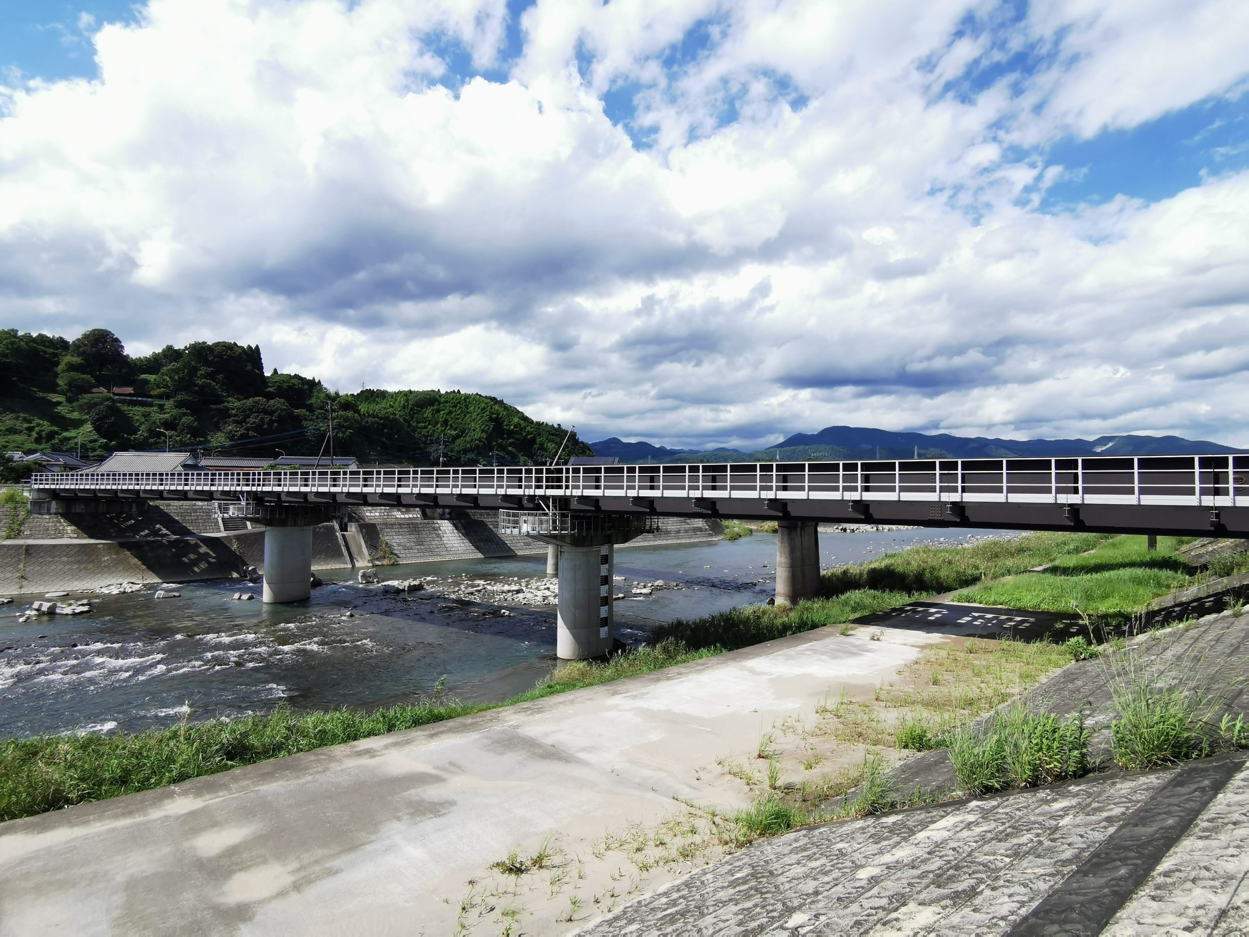
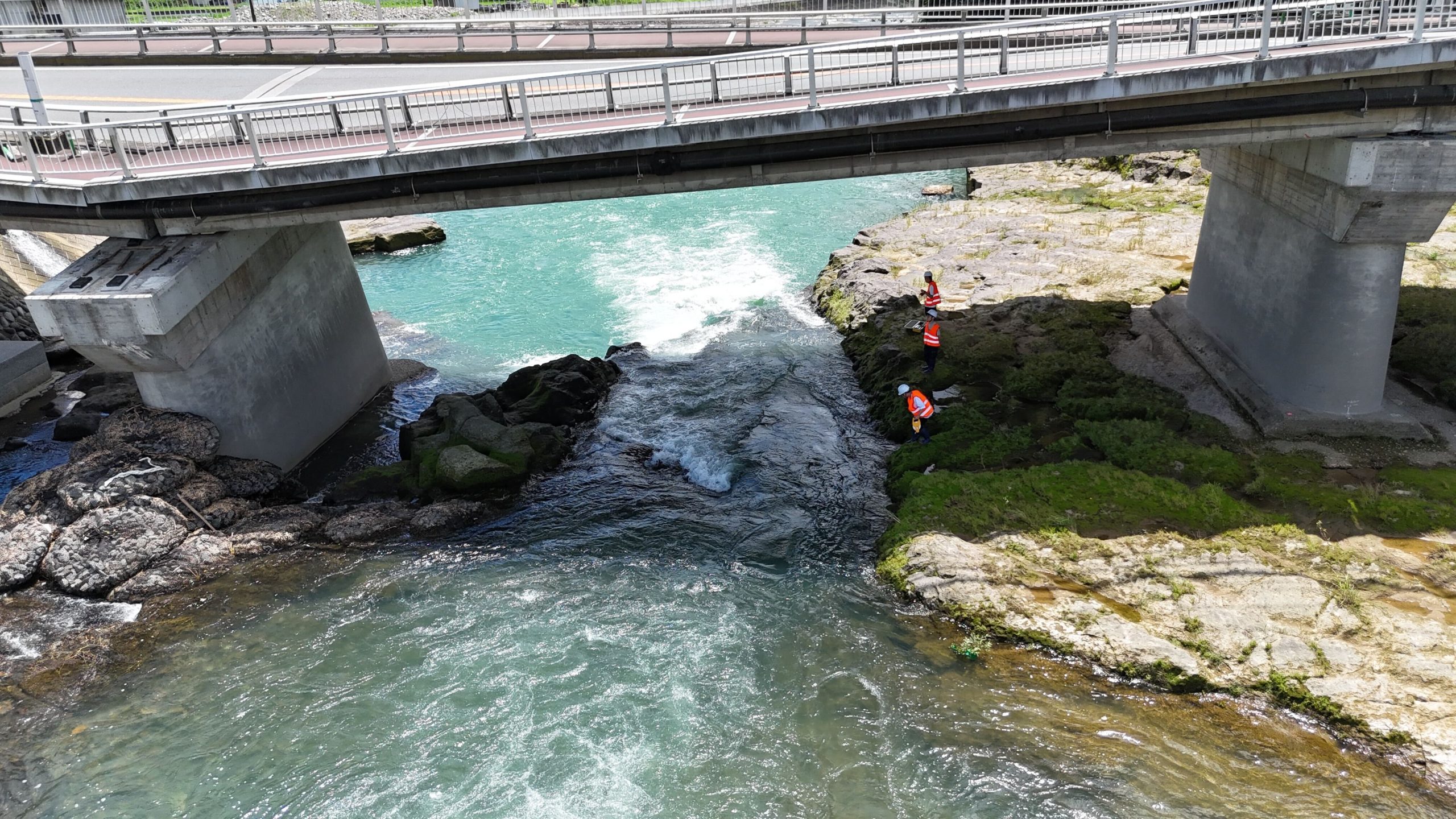
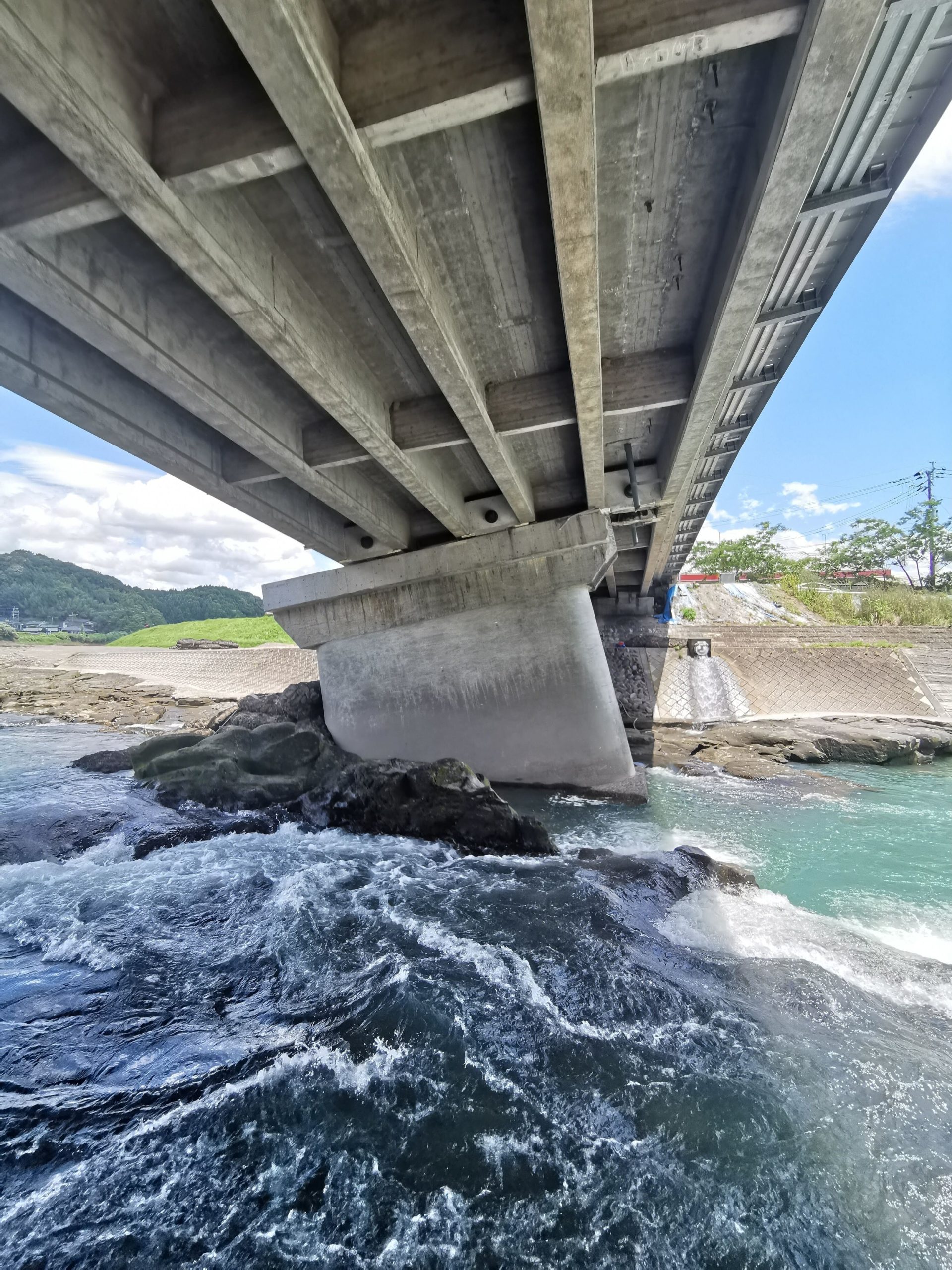
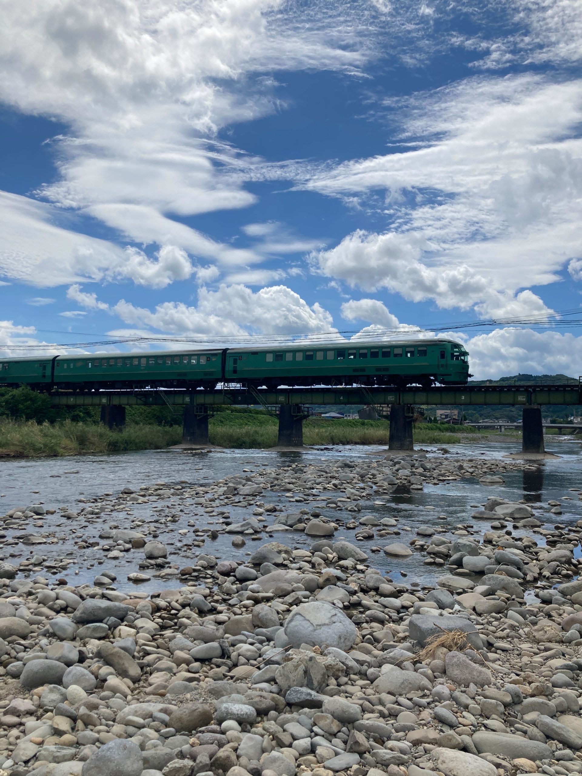
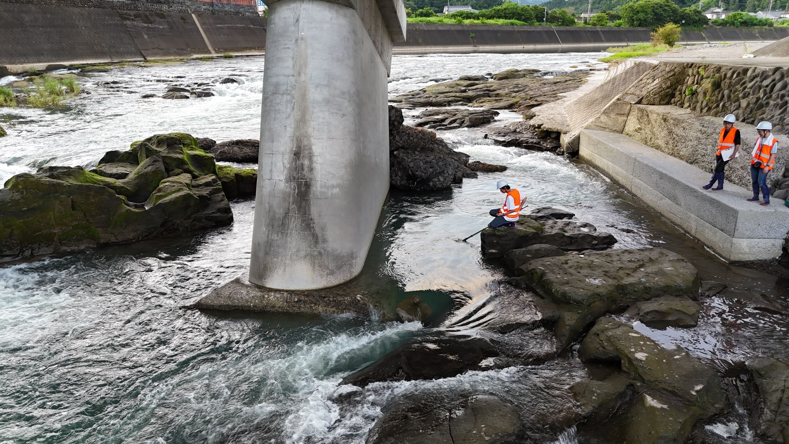
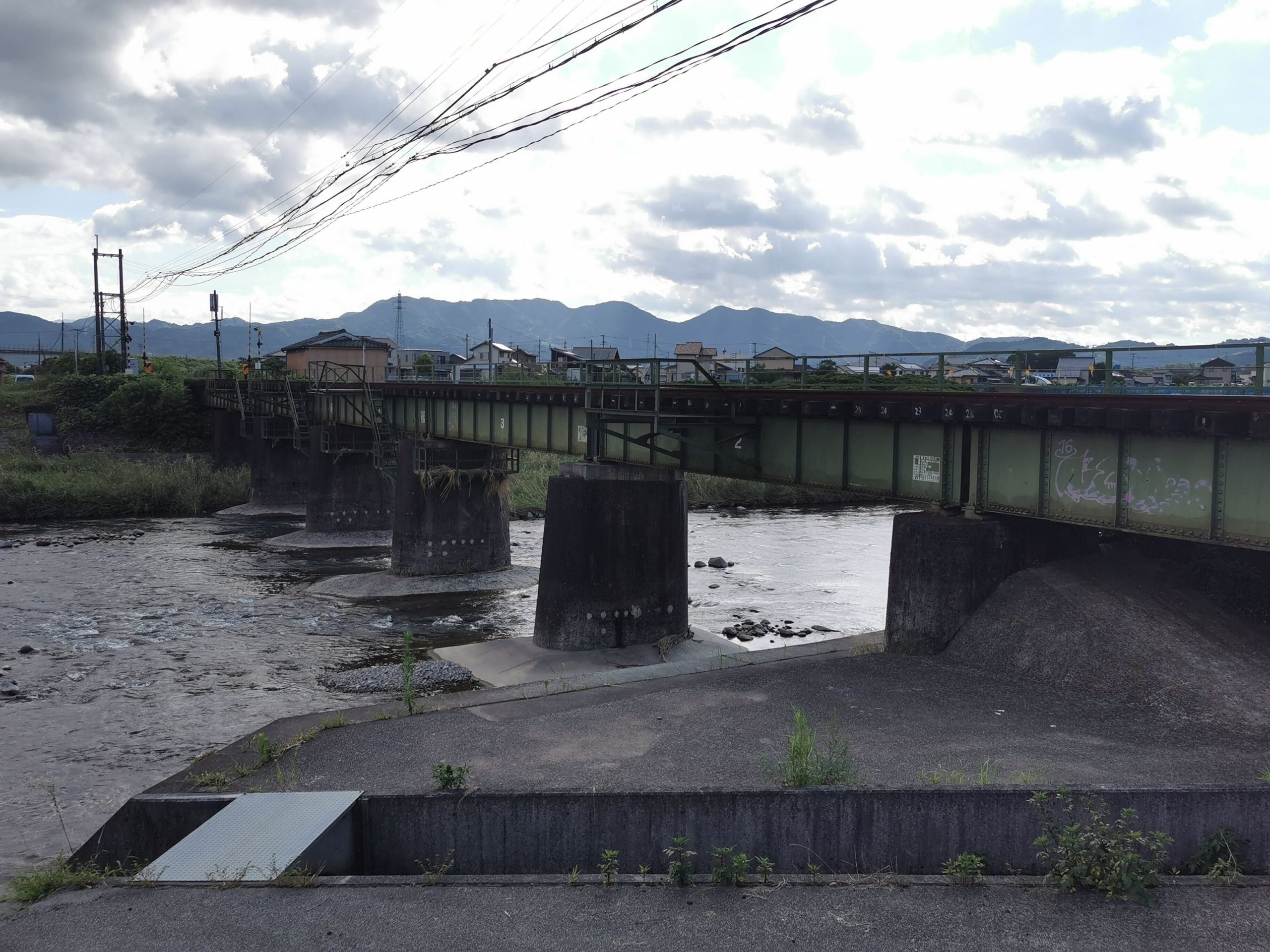
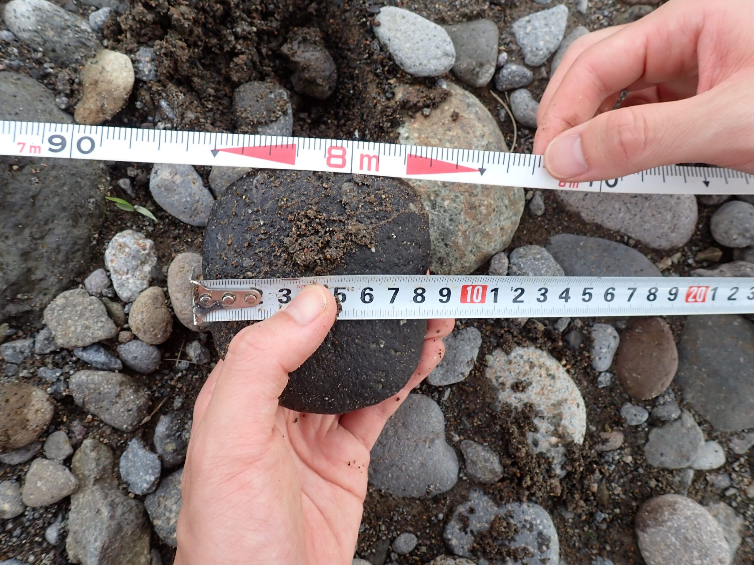
2024年7月18・19日の2日間に、先日の大雨で被災した国道386号の三郎丸橋(大分県日田市)、および過去の豪雨被害から復旧した久大本線の花月川橋梁(大分県日田市)・隈上川橋梁(福岡県うきは市)の現場視察を行った。現時点で通行不能となっている三郎丸橋では、ドローンを活用し、橋梁の被災状況および橋脚上下流の河道に関する調査を行った。また、2017年九州北部豪雨で流失し架け替えられた花月川橋梁では、復旧後の橋桁形式を、2012年九州北部豪雨で橋脚が沈下する被害を受けた隈上川橋梁では、河床材料の粒度組成を中心に調査を行った。
橋脚の局所洗掘および橋脚直下地盤の吸出し問題に関しては、地盤工学に加えて、河川工学の見地も踏まえた検証を行う必要がある。現場視察を通して、橋脚形状や河床勾配・河床材料の粒度組成など現地でしか得られない情報が得られ、人々の生活に重大な影響をもたらす橋脚洗掘被害に関する知見を深める大きな一歩となった。
On July 18 and 19, 2024, a field survey was conducted at the Saburomaru Bridge (Hita City, Oita Prefecture) on National Route 386, which was damaged by the recent heavy rains, and at the Kagetsu River Bridge (Ukiha City, Fukuoka Prefecture) and the Kumanoue River Bridge (Hita City, Oita Prefecture) on the JR Kyudai Main Line, which were restored from past heavy rain damages. At the Saburomaru Bridge, which is currently closed, a drone was used to survey the damage to the bridge and the river channel above and below the bridge piers. The survey focused on the bridge girder structure at the Kagetsu River Bridge after restoration and focused on measuring riverbed particle size distribution at the Kumanoue River Bridge.
Regarding the issue of local scouring of bridge piers and suffusion beneath bridge piers, it is necessary to conduct examinations from the perspective of river engineering in addition to geotechnical engineering. Through the survey, valuable information that can only be obtained in-situ, such as pier shapes, riverbed gradients, and particle size distribution of riverbeds, was gathered. This marked a significant step forward in deepening our understanding of the scouring problems affecting bridge piers, which can cause severe damage to people’s lives.
(Updated July 31, 2024)